Property development is quite a vast field, and there is a range of professions associated with the field, each with job descriptions that aren’t always the most straightforward to understand. In this article, we will explore the fascinating world of land surveyors. What do they do, and why do we need them?
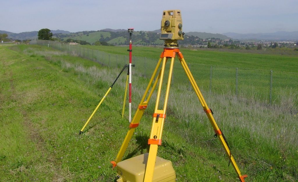
Have you ever been driving along and happened to notice an individual wearing a hard hat and peering through a telescopic device set on a tripod? They will usually be looking to the horizon or a height stick being held by someone else, usually an apprentice. These are land surveyors and they work on a range of projects, from planning and design of new or existing infrastructure, land and building development, construction (buildings, roads, bridges, sports fields, farming, etc.) to monitoring and environmental measuring.
Land surveyors are experts at determining land size and measurements, as well as topographic heights. This allows them to advise and inform the work of other professionals like engineers, architects, city planners, property developers and more. They are usually the first people on any job site, measuring and mapping the land. Their measurements are then used by engineers and architects to determine whether a structure can be safely built, and how to make the most of the surroundings when designing the building.
Why do renovators and developers need their land surveyed?
In simple terms, if you want to renovate or develop a property, you need to make sure that your proposed project will comply with the various building codes and town planning codes, like the wall distance from the property’s boundary line. You also need to obtain a planning permit before building, renovating, developing, subdividing, or changing a land’s use, which will require the planned project to be reviewed against various other planning documents. If you want to build a solid case, you need the help of an expert land surveyor to ensure you can address and accommodate any issues that may come up while still completing the planned project.
Existing Conditions Survey
A special type of survey, called an Existing Conditions Survey, or site and context plan may be needed for renovation or development projects. This involves a professional land surveyor reviewing the site and the surrounding area and providing details of buildings, vegetation and fences, the slope of the land, building heights, road features and any utility services that are currently present. This may also involve re-determining the exact boundaries of the property since this may be different from the existing fence lines. This is particularly important if your planned works are anywhere close to the perceived boundaries of the property.
What happens to the land survey information?
By using specialized equipment such as levels, electronic theodolites, tapes and Global Navigation Satellite System (GNSS) units, surveyors can accurately measure land and define boundaries. Once they have surveyed a property, they draw up a plan for their client and if necessary, lodge the subdivision plan to the relevant government department. The boundaries registered by land surveyors are then recorded in the State’s land information system, which includes the boundaries of privately owned and government land, survey plans, survey field records, ownership information, easements and other land information.
Why you must use a licensed surveyor
A licensed surveyor is the only person legally entitled to undertake a survey to mark the boundaries of your property. It’s vitally important to understand that surveys prepared by non-licensed surveyors do not have legal standing and will not be recognized as evidence in the event of a boundary dispute. It’s not worth the risk, so make sure you only use a licensed professional, like Flat Out Surveying to survey your land.
Have you ever hired a land surveyor for any reason? Share your experiences in the comments below!